|
Looking ahead to next month, SEAS-5 initially was supportive of the idea of a stratospheric PV stretching event this winter in Jan or Feb but has since backed off some, however I think it's still in the cards. Newest guidance has what we need, just slightly out of place. NPac & Ural ridging is in a good spot, but lower heights centered over James Bay are too far SW to support this idea. Ideally, you want lower heights over Greenland (which can still happen since I don't put tons of stock into these plots). Another area of interest are lower heights just east of Scandinavia. Not ideal either. At the moment it is a subtle signal but still worth monitoring. 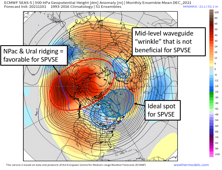 January SEAS-5 has robust NPac ridging and a downstream trough over western-central Canada. For cold/snow lovers in the Southern Plains this is a good look, where an antecedent cold air mass could support frozen precip for any trough that moves through. Given how last year went for the Great Plains, I think these plots hold some merit, especially with ENSO being negative again. 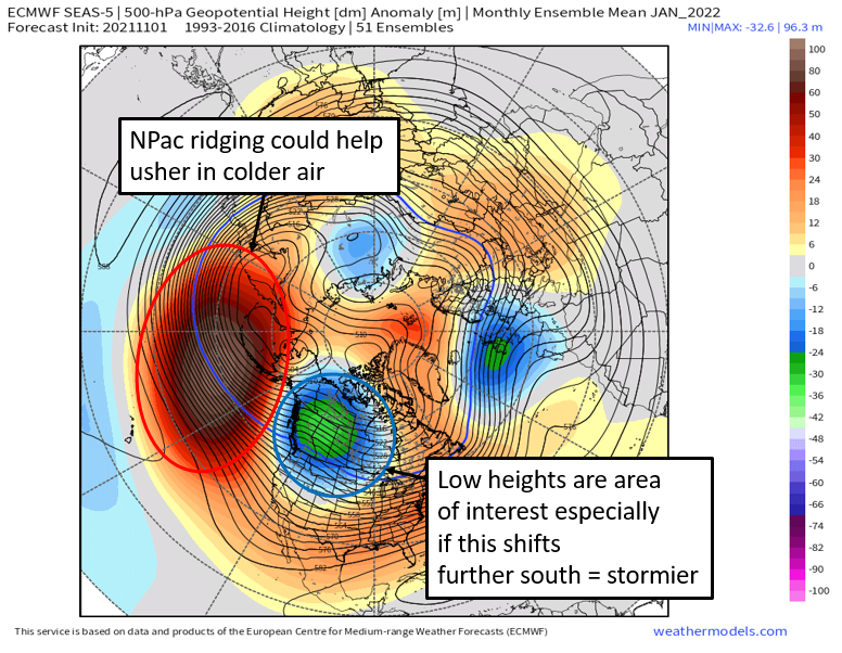
0 Comments
|
